The Original Noah's Tzohar
Noah's Tzohar And The Sahara Desert
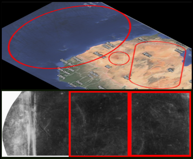
The Sahara Desert long overlooked has finally been identified as a deliberate man made artwork masterpiece spread across these multiple countries created by this alliance of Kings and World leaders, together with their dynastic successors, who combined their resources and influence to travel across vast desert regions of the world in order to physically reproduce the hidden engravings found on Noah’s Tzohar upon the surface of the earth itself. Examination of aerial and satellite imagery across the great desert landscapes of North Africa — particularly the vast expanse of the Sahara Desert — has revealed landforms, ridges, and carved ground formations that correspond with the engraved patterns preserved on the Tzohar stone itself. The satellite imagery below of the Sahara Desert shows an ancient man made engraved drawing of a man riding a flying dragon this image would have taken Kings armies years to make. This was done to disguised and safeguard underground bunkers filled with tons of gold bars, large amounts of gold coins, and other precious metals, this was not only done in the Sahara Desert, it was done worldwide.

The Sahara Desert, the world's largest and hottest desert on Earth, stretches nearly 4,800 kilometers across from sea to sea, has developed over millions of years, yet many of its visible surface patterns, when viewed from high altitude, still form the ancient shapes and alignments of these ancient man made markings to date. These large-scale designs suggest that ancient surveyors working under a powerful international alliance carefully mapped and altered sections of the desert terrain so that the engravings on the Tzohar were reproduced on a monumental geographical scale only visible from the sky above.

The highlighted satellite imagery as seen above depicts four out of the twelve identified ancient maps overlapping each other as seen on both sides of the Tzohar. The highlighted image in gold shows a two headed beast, which is a merge between a ram, and a buffalo. This particular image on one of the maps, Joshua Darling discovered to exist, in addition to this, so far within the countries The Commonwealth of The Bahamas, The United States of America, Easter Island located in The Republic of Chile, and in the Zagros Mountains, particularly in Northeastern Iraq, and the highlighted images in blue and red terminators (ovals) as running oblique depict two ancient images strongly resembling the design of the Eiffel Tower in Paris, France. However these two ancient man made engravings were affixed to the earth centuries before the Eiffel Tower design was even created, or built.

The highlighted satellite imagery in a red oval depicts the said fictional character of Pharaoh Antom and Yu-Gi-Oh Mutao, the King of Games. The highlighted red square shows other Kings and servants bowing down paying respect to the late Pharaoh. It is believed that this is the burial tomb of the real said Pharaoh Antom and the location of all said seven so called fictional millennium items, two of which were used around 3,000 BC in the real battle of the Egyptian demon gods to control Seth the Sky demon vs Apep the ground demon better known as Obelisk The Tormentor vs Slifer the Sky Dragon as portrayed the modern said to be fictional TV show Yu-Gi-Oh: King Of Games.

This network served as the earliest attempts in forming a worldwide financial World Bank banking system infrastructure designed with no infrastructure and yet still securely safeguarding vast quantities of tons of gold bars, large gold coins, and other precious metals deposits, distributed intended for international trade. This ambitious undertaking represented an ancient attempt in establishing a global New World Order — only those in the alliance were allowed to trade. And with Kings such as King Mansa Musa for example who were apart of the alliance and betrayed his fellow Kings and initiated war frequently against neighboring Kingdoms taking their country's Tzohar gold deposits as his the system ultimately had no choice but to fail, leaving behind only the immense landscape engravings and geographical patterns that remain visible today from aerial observation, many of which are believed to still hold undisclosed amounts of gold deposits in them worldwide, which all locations have at least one of the many Tzohar maps which correspond to the hidden markings preserved on Noah’s Tzohar as the only access card in the world.
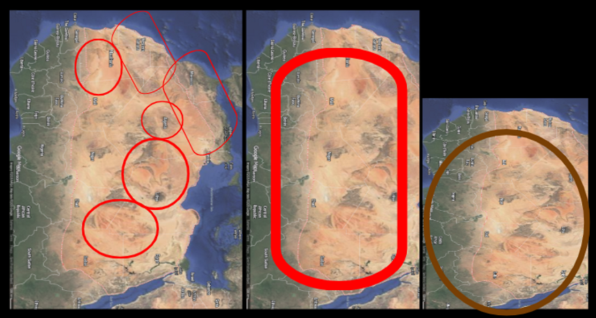

Within these aerial patterns featured in both the large red and gold shaped ovals form figures representing Heqet, the Egyptian demon frog Queen goddess linked to demonic fertility, rebirth, and the life-giving power of the River Nile. Heqet lived and was one of the longest worshiped demons in ancient Egypt from 4,000 BC to 30 BC. She was commonly depicted as a woman with a frog head and sometimes shapeshifting into a talking frog wearing a crown. She generally symbolized demonic creation and the emergence of demon life. Some of the aerial desert markings seen above appear to form large symbolic outlines reminiscent of this ancient demon in its second form when viewed from above. These markings — carved into desert terrain and other landscapes around the world — were part of a coordinated global system established by this alliance.

These aerial desert markings both above and below form the large ancient engraved image located at the center of Noah's Tzohar at the darkest point believed to represent what Adam and Eve truly looked like, and the highlighted red circle seen around the ocean resembles the face of a cat.